
West Midlands Police reduces knife crime by 16% with new data analysis techniques
West Midlands Police is using data analysis techniques to help tackle serious violent crime and reduce the cost of crime.
Using the latest geospatial tools from Esri UK the force has gained a more accurate understanding of violent crime hotspots, down to street level and individual property, enabling more targeted policing. The project is part of the Hot Spot Action Programme funded by the Home Office.
Results in the past 12 months include reducing knife crime by 16 per cent, making 812 arrests and seizing more than 500 weapons. The cost of crime to society has also been reduced by £13 million.
These are the latest milestones in West Midlands Police’s move to combine its POP (Problem Oriented Policing) training with the latest geospatial analysis techniques to tackle knife crime.
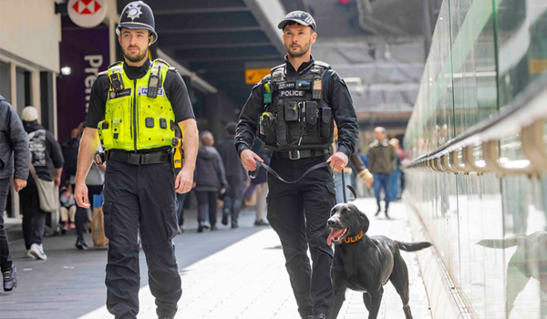
The highly targeted approach is being spearheaded by a specialist taskforce named Project Guardian, created in 2024 to reduce knife crime and serious youth violence as a top priority. With more than 7,000 knife-related offences a year, the West Midlands had the highest rate of knife crime per capita in England.
The taskforce invested in two geospatial analysts coupled with advanced geospatial software from Esri UK, to modernise methods and provide direct support to tactical operations. The new approach involves targeting specific crime types with particular policing techniques and specialist officers, including plain-clothes operations and high-visibility patrols. Along with enforcement, the Guardian officers also engage with and educate young people around the life-changing impact of knife crime.
Project Guardian lead at West Midlands Police, Detective Chief Inspector John Askew, said: “Applying new analysis techniques is critical in discovering robust methods to combat serious violent crime.
“Having access to the most sophisticated software means our analysis is more accurate and also quicker to achieve. Our patrols can now act on intelligence from Esri tools and focus their attention on the right places and help reduce knife crime.
“The latest figures reflect some very significant changes to the way we police. The intelligence our analysts can now deliver means less weapons on the streets and reduced crime numbers across the region.”
The analysis has been used to inform location-specific SARA (Scanning, Analysis, Response and Assessment) plans, and has already contributed to the reduction in knife crime across 15 SARA areas. It directed 35,000 hours of patrols between January 2024 and January 2025, leading to the seizure of more than 500 weapons and 812 arrests. Interactive map visuals help share the analysis with officers throughout the force making it easy for all to understand.
To achieve the new approach, analysts first examined knife and other violent crime data from 2021-2024 to identify hotspots of harm. ‘Risky facilities’, including nightclubs, bus stations and fast-food outlets, were then revealed within the hotspots, where there is a higher probability of serious incidents. Finally, using the 80/20 analysis tool the team pinpointed streets with the highest risk of crime. This technique identifies the locations where incidents are disproportionately occurring (for example, 80 per cent of incidents occur at 20 per cent of locations).
Other innovations include using the Esri Weighted Displacement Difference Tool to show whether tactics are having an effect on a crime type and area. This intelligence is key to understanding where Project Guardian has the highest chance of preventing crimes with the resources available.
While Project Guardian is primarily focused on reducing deaths and injuries from violent crime, West Midlands Police says it has also calculated its geospatial approach has helped it to reduce the annual cost of crime on society by more than £13 million.
“West Midlands Police is among the first forces in the UK to elevate its application of geographic analysis to help prevent crime,” commented Chris Gardiner, head of Sector, Public Safety, Esri UK.
“Using these latest policing analysis techniques and investing in new skills, the force is modernising its understanding of crime hotspots and precisely targeting the worst affected areas which achieves better results.”
Future plans to develop the system include the use of a mobile patrol solution to improve intelligence on activity and reporting of hotspot patrols.