
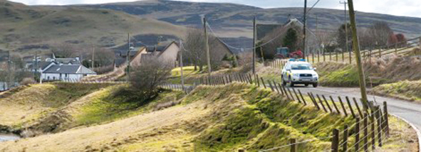
Rural communities encouraged to download geolocation apps
Scotlands emergency services have launched a joint initiative to encourage people living and working in rural areas to download a geolocation app that will help them locate their exact position in the event of a call for help.
Scotlands emergency services have launched a joint initiative to encourage people living and working in rural areas to download a geolocation app that will help them locate their exact position in the event of a call for help.
By downloading the app to their smartphone or smartwatch, they can give emergency call handlers their exact Ordnance Survey grid reference and all three emergency service control centres Police Scotland, Ambulance Service and Fire and Rescue Service can use these Eastings and Northings (eastward-measured distance and northward-measured distance) to plot their location, reducing the time taken to respond to incidents and improving the service provided to the public.
Accurately identifying a rural location, particularly remote locations several miles from a listed road, can be problematic and people who work in remote or rural areas are being encouraged to use these geolocation apps, many of which can be downloaded and used for free, such as the OS Locate app produced by Ordnance Survey.
Chief Inspector Stuart Simpson of Police Scotlands Contact, Command and Control Division and a member of the Scottish Partnership Against Rural Crime (SPARC), explained: By giving the Eastings and Northings, the geolocator apps provide an easy way for people in rural areas to give their location when calling the emergency services.
This information can then be used by the control centre operators to plot the exact location and direct the police officer, fire crew or ambulance to the incident. We hope that this would improve the contact from and reporting of incidents from those who live, work or visit our rural areas.
Assistant Chief Officer Lewis Ramsay, from the Scottish Fire and Rescue Service, said: The Scottish emergency services all receive calls from the public who are not always familiar with their location. We therefore welcome any use of technology that could assist the ability of emergency services to detect people in need in rural areas.
Daren Mochrie, director of Service Delivery, Scottish Ambulance Service, added: Our air and road ambulance teams respond to 999 calls for assistance from remote and rural areas across Scotland. While they are supported by sophisticated mapping and GPS systems, any additional location information from the scene that highlights local landmarks will help crews to locate patients as quickly as possible.